Geolocate

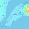
La Paz topographic map

Click on the map to display elevation.

About this map

Name: La Paz topographic map, elevation, terrain.

Location: La Paz, Zamboanga City, Zamboanga Peninsula, 7000, Philippines (7.00282 121.97256 7.04282 122.01256)

Average elevation: 632 m

Minimum elevation: 207 m

Maximum elevation: 914 m

Other topographic maps

Click on a map to view its topography, its elevation and its terrain.

Sacol Island

Philippines > Zamboanga City

Average elevation: 6 m

Vitali River

Philippines > Zamboanga City > Mangusu

Average elevation: 27 m

Sinunug Island

Philippines > Zamboanga City

Average elevation: 0 m

Plaza Pershing

Philippines > Zamboanga City

Average elevation: 4 m

Gear up for your next adventure:

🧥Waterproof Jacket - Lightweight rain jackets for hiking and outdoor activities
🥾Hiking Shoes - Durable and comfortable shoes for trail hiking
🧼Biodegradable Camp Soap - Environmentally friendly cleaning for gear and body
👟Sport Hiking Sandals - Breathable footwear for water crossings and camp rest
🚲Handlebar Phone Mount - View topographic-map.com live while cycling

As an Amazon Associate, this site earns from qualifying purchases at no extra cost to you.