Geolocate

Lakshmipur topographic map

Click on the map to display elevation.

About this map

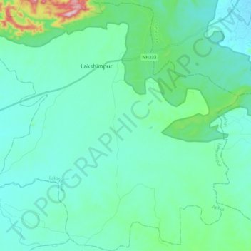
Name: Lakshmipur topographic map, elevation, terrain.

Location: Lakshmipur, Jamui, Bihar, India (24.87452 86.31095 25.05197 86.50641)

Average elevation: 126 m

Minimum elevation: 66 m

Maximum elevation: 466 m

Gear up for your next adventure:

💡Compact LED Flashlight - Powerful and portable flashlight for outdoor use
🥾Hiking Boots - Sturdy boots providing ankle support and traction on rugged trails
🧥Packable Rain Jacket - Breathable waterproof layer for unpredictable weather
🛶Kayak Dry Bag - Waterproof storage for kayaking adventures
🧥Fleece Jacket - Warm and lightweight jacket for layering

As an Amazon Associate, this site earns from qualifying purchases at no extra cost to you.