
Pointe Michel topographic map
Interactive map
Click on the map to display elevation.
About this map
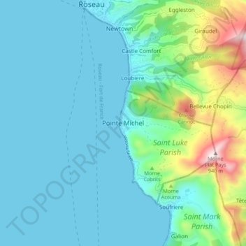
Name: Pointe Michel topographic map, elevation, terrain.
Location: Pointe Michel, Saint Luke Parish, Dominica (15.22049 -61.41668 15.30049 -61.33668)
Average elevation: 163 m
Minimum elevation: -1 m
Maximum elevation: 918 m