Geolocate

Braswell topographic map

Click on the map to display elevation.

About this map

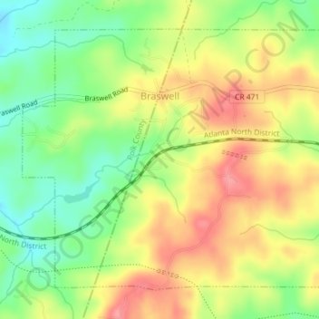
Name: Braswell topographic map, elevation, terrain.

Location: Braswell, Paulding County, Georgia, United States (33.97126 -84.97830 33.99567 -84.94235)

Average elevation: 329 m

Minimum elevation: 284 m

Maximum elevation: 373 m

Other topographic maps

Click on a map to view its topography, its elevation and its terrain.

Nebo

United States > Georgia > Paulding County > Hiram

Average elevation: 317 m

Cross Roads

United States > Georgia > Paulding County

Average elevation: 293 m

Brownsville

United States > Georgia > Paulding County

Average elevation: 299 m

New Hope

United States > Georgia > Paulding County

Average elevation: 317 m

Ash

United States > Georgia > Paulding County

Average elevation: 319 m

Ray Mountain

United States > Georgia > Paulding County

Average elevation: 306 m

Gear up for your next adventure:

🥾All-Terrain Hiking Boots - Versatile boots for varied hiking conditions
🎒Backpack Rain Cover - External shield to keep your entire pack dry
🧥Waterproof Pants - Keep dry during rainy hiking conditions
👟Trail Running Shoes - Agile footwear for fast-paced topographic exploration
🚲MTB Frame Bag - Carry tools and maps directly on your bicycle frame

As an Amazon Associate, this site earns from qualifying purchases at no extra cost to you.