Geolocate

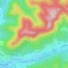
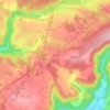
Sanchey topographic map

Click on the map to display elevation.

About this map

Name: Sanchey topographic map, elevation, terrain.

Location: Sanchey, Épinal, Vosges, Grand Est, Metropolitan France, 88390, France (48.14868 6.35257 48.18666 6.38906)

Average elevation: 381 m

Minimum elevation: 340 m

Maximum elevation: 465 m

Other topographic maps

Click on a map to view its topography, its elevation and its terrain.

Haute Murée

France > Grand Est > Vosges > Moyenmoutier

Average elevation: 438 m

Le Régit

France > Grand Est > Vosges

Average elevation: 995 m

Haute Murée

France > Grand Est > Vosges > Moyenmoutier

Average elevation: 438 m

La Mauselaine

France > Grand Est > Vosges > Gérardmer

Average elevation: 859 m

Remanvillers

France > Grand Est > Vosges > Ferdrupt

Average elevation: 568 m

La Schlucht

France > Grand Est > Vosges > Le Valtin

Average elevation: 1,039 m

Le Motiron

France > Grand Est > Vosges > Le Val-d'Ajol

Average elevation: 553 m

Aureil-Maison

France > Grand Est > Vosges > Lamarche

Average elevation: 394 m

Hamanxard

France > Grand Est > Vosges > Le Val-d'Ajol

Average elevation: 563 m

Haute Murée

France > Grand Est > Vosges > Moyenmoutier

Average elevation: 438 m

Au-dessus de Cobey

France > Grand Est > Vosges > Igney

Average elevation: 325 m

Royes

France > Grand Est > Vosges > Removille

Average elevation: 352 m

Le Chêne

France > Grand Est > Vosges > Rupt-sur-Moselle

Average elevation: 576 m

La Mergerie

France > Grand Est > Vosges > Chef-Haut

Average elevation: 360 m

Gear up for your next adventure:

🎒Backpack Rain Cover - External shield to keep your entire pack dry
🥾Mountaineering Boots - Supportive boots for climbing and high-altitude hiking
💡Portable Camping Lamp - Rechargeable lamp for campsite lighting
🧭Orienteering Kit - Tools for map reading and navigation in the wild
🧥Waterproof Jacket - Lightweight rain jackets for hiking and outdoor activities

As an Amazon Associate, this site earns from qualifying purchases at no extra cost to you.