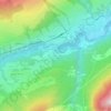
Samnaun topographic map
Click on the map to display elevation.
Samnaun
La vallée de Samnaun est la plus en aval sur la rive gauche du cours de l'Inn (rivière) en Suisse. La commune regroupe cinq fractions (ou hameaux) : Compatsch, Laret, Plan (Plaun), Ravaisch et Samnaun, entre les altitudes de 1 700 et 1 840 m. Ouverte face au Sud, c'est une vallée sèche où les ressources en eau se raréfient.
About this map

Name: Samnaun topographic map, elevation, terrain.
Location: Samnaun, Engiadina Bassa/Val Müstair, Grisons, Suisse (46.89771 10.30613 47.00053 10.43419)
Average elevation: 2,369 m
Minimum elevation: 1,481 m
Maximum elevation: 3,262 m
Other topographic maps
Click on a map to view its topography, its elevation and its terrain.