
Seongbuk-dong topographic map
Interactive map
Click on the map to display elevation.
About this map
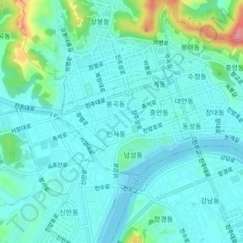
Name: Seongbuk-dong topographic map, elevation, terrain.
Average elevation: 44 m
Minimum elevation: 19 m
Maximum elevation: 154 m
Other topographic maps
Click on a map to view its topography, its elevation and its terrain.
Jinju-si
South Korea > Gyeongsangnam-do > Jinju-si
Jinju-si, Gyeongsangnam-do, South Korea
Average elevation: 125 m