Geolocate

Cantera topographic map

Click on the map to display elevation.

About this map

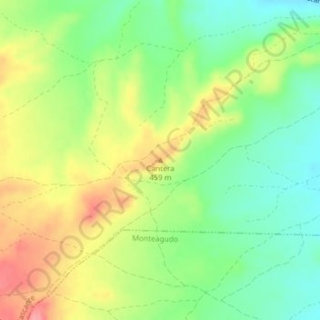
Name: Cantera topographic map, elevation, terrain.

Location: Cantera, Cascante, Ribera, Navarra, 31520, España (41.98404 -1.72319 41.98414 -1.72309)

Average elevation: 425 m

Minimum elevation: 384 m

Maximum elevation: 477 m

Gear up for your next adventure:

🥾Hiking Shorts - Breathable shorts suitable for summer hikes
🛁Quick-Dry Microfiber Towel - Space-saving towel that dries rapidly on the move
🥤Collapsible Travel Cup - Saves space and weight in your mess kit
🧣Evaporative Cooling Towel - Beat the heat during intense summer climbs
Family Camping Tent - Spacious tent suitable for family camping trips

As an Amazon Associate, this site earns from qualifying purchases at no extra cost to you.