Geolocate

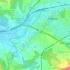
Beaudinard topographic map

Click on the map to display elevation.

About this map

Name: Beaudinard topographic map, elevation, terrain.

Location: Beaudinard, Aubagne, Marseille, Bouches-du-Rhône, Provence-Alpes-Côte d'Azur, France métropolitaine, 13400, France (43.29121 5.56514 43.33121 5.60514)

Average elevation: 151 m

Minimum elevation: 97 m

Maximum elevation: 531 m

Other topographic maps

Click on a map to view its topography, its elevation and its terrain.
Gear up for your next adventure:

🥾Trail Hiking Shoes - Durable shoes designed for rugged trails
🥤Collapsible Travel Cup - Saves space and weight in your mess kit
🥾Lightweight Hiking Shoes - Comfortable shoes for day hikes
⛺Family Camping Tent - Spacious tent suitable for family camping trips
🗺️Topographic Maps - Detailed maps to explore trails, mountains, and wilderness areas

As an Amazon Associate, this site earns from qualifying purchases at no extra cost to you.