Geolocate

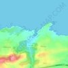
Debodes topographic map

Click on the map to display elevation.

About this map

Name: Debodes topographic map, elevation, terrain.

Location: Debodes, Caldueño, Llanes, Asturias, 33592, España (43.35831 -4.91872 43.39831 -4.87872)

Average elevation: 265 m

Minimum elevation: 45 m

Maximum elevation: 927 m

Other topographic maps

Click on a map to view its topography, its elevation and its terrain.

Meré

España > Asturias > Llanes

Average elevation: 351 m

Río de Nueva

España > Asturias > Llanes > Picones

Average elevation: 25 m

Ardisana

España > Asturias > Llanes

Average elevation: 406 m

Gear up for your next adventure:

🧢Sun Protection Cap - Breathable cap to protect from sun exposure
🦯Trekking Poles - Reduced impact on joints for steep topographic climbs
⛺Lightweight Camping Tent - Portable shelter optimized for Canadian backcountry camping
🥾Approach Shoes - Shoes designed for climbing approaches and rugged trails
🩹Compact First Aid Kit - Pre-packed essentials for common trail injuries

As an Amazon Associate, this site earns from qualifying purchases at no extra cost to you.