Geolocate

Edwards topographic map

Click on the map to display elevation.

About this map

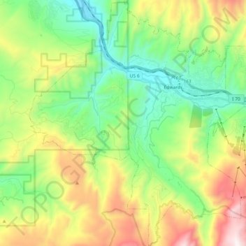
Name: Edwards topographic map, elevation, terrain.

Location: Edwards, Eagle County, Colorado, 81632, United States (39.55483 -106.69977 39.69406 -106.54128)

Average elevation: 2,598 m

Minimum elevation: 2,136 m

Maximum elevation: 3,458 m

Gear up for your next adventure:

🧊Insulated Water Bottle - Keeps drinks cold in summer and prevents freezing in winter
🥾Approach Shoes - Shoes designed for climbing approaches and rugged trails
🥾Trail Hiking Boots - Supportive boots for rough trails
💡LED Headlamp - Hands-free illumination for night hiking and camping
📷Outdoor Action Camera - Capture high-elevation views and rugged adventures

As an Amazon Associate, this site earns from qualifying purchases at no extra cost to you.