Geolocate

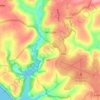
High Cliff topographic map

Click on the map to display elevation.

About this map

Name: High Cliff topographic map, elevation, terrain.

Location: High Cliff, Cornwall, England, PL35 0HN, United Kingdom (50.71761 -4.65044 50.71771 -4.65034)

Average elevation: 113 m

Minimum elevation: 0 m

Maximum elevation: 258 m

Other topographic maps

Click on a map to view its topography, its elevation and its terrain.
St. Austell

United Kingdom > England > Cornwall

Average elevation: 104 m

Penryn

United Kingdom > England > Cornwall

Average elevation: 57 m

Tintagel

United Kingdom > England > Cornwall

Average elevation: 89 m

Liskeard

United Kingdom > England > Cornwall

Average elevation: 113 m

Saltash

United Kingdom > England > Cornwall

Average elevation: 28 m

Hayle

United Kingdom > England > Cornwall

Average elevation: 30 m

Padstow

United Kingdom > England > Cornwall

Average elevation: 29 m

Kilminorth Woods

United Kingdom > England > Cornwall > Looe > West Looe

Average elevation: 69 m

Launceston

United Kingdom > England > Cornwall

Average elevation: 119 m

Porthcurno

United Kingdom > England > Cornwall > Porthcurno > St. Levan

Average elevation: 39 m

Bodmin

United Kingdom > England > Cornwall

Average elevation: 104 m

Watergate Bay

United Kingdom > England > Cornwall > Newquay > Tregurrian

Average elevation: 12 m

Helston

United Kingdom > England > Cornwall

Average elevation: 57 m

St. Levan

United Kingdom > England > Cornwall > Porthcurno

Average elevation: 57 m

Lanner

United Kingdom > England > Cornwall

Average elevation: 162 m

Gear up for your next adventure:

🧢Hiking Sun Hat - Wide-brimmed protection for exposed mountain ridges
🥾Hiking Shorts - Breathable shorts suitable for summer hikes
🥾Approach Boots - Comfortable boots for hiking and climbing approaches
🚲Heavy Duty Bike Lock - Secure your bike at the trailhead or during stops
🧢Sun Hat - Wide-brim hat for sun protection

As an Amazon Associate, this site earns from qualifying purchases at no extra cost to you.