
Ward 3 topographic map
Click on the map to display elevation.
About this map
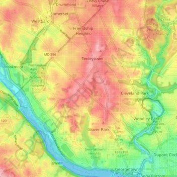
Name: Ward 3 topographic map, elevation, terrain.
Location: Ward 3, Washington, District of Columbia, United States (38.90218 -77.11979 38.97192 -77.04050)
Average elevation: 70 m
Minimum elevation: -2 m
Maximum elevation: 132 m
Other topographic maps
Click on a map to view its topography, its elevation and its terrain.
United States National Arboretum
United States > District of Columbia > Washington
Average elevation: 21 m
United States National Arboretum
United States > District of Columbia > Washington
Average elevation: 21 m