Geolocate

Todey topographic map

Click on the map to display elevation.

About this map

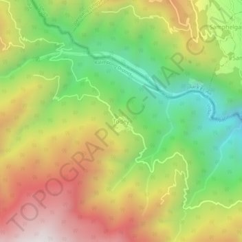
Name: Todey topographic map, elevation, terrain.

Location: Todey, Gorubathan, Kalimpong District, West Bengal, India (27.09083 88.80523 27.13083 88.84523)

Average elevation: 1,325 m

Minimum elevation: 756 m

Maximum elevation: 1,969 m

Other topographic maps

Click on a map to view its topography, its elevation and its terrain.

Neora Valley National Park

India > West Bengal > Gorubathan > Rongo

Average elevation: 1,309 m

Gear up for your next adventure:

💧Hydration Pack - Hands-free hydration system for long hikes
🧭Orienteering Kit - Tools for map reading and navigation in the wild
🥾Mountaineering Boots - Supportive boots for climbing and high-altitude hiking
🔋Emergency Crank Radio - Weather alerts and power without needing batteries
Camping Tent - Weather-resistant tents suitable for 2 to 6 people

As an Amazon Associate, this site earns from qualifying purchases at no extra cost to you.