
Thank you for supporting this site ❤️
Make a donation
Make a donation
Gear up for your next adventure:
As an Amazon Associate, this site earns from qualifying purchases at no extra cost to you.
Gomma topographic map
Click on the map to display elevation.
Thank you for supporting this site ❤️
Make a donation
Make a donation
Gear up for your next adventure:
As an Amazon Associate, this site earns from qualifying purchases at no extra cost to you.
About this map
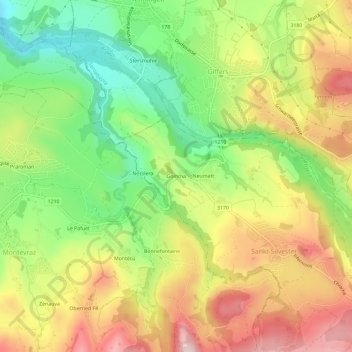
Name: Gomma topographic map, elevation, terrain.
Location: Gomma, St. Silvester, Sensebezirk, Fribourg, 1735, Switzerland (46.72960 7.18305 46.76960 7.22305)
Average elevation: 781 m
Minimum elevation: 633 m
Maximum elevation: 941 m
Thank you for supporting this site ❤️
Make a donation
Make a donation
Gear up for your next adventure:
As an Amazon Associate, this site earns from qualifying purchases at no extra cost to you.