
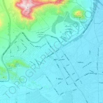
دهستان ماربین سفلی topographic map
Interactive map
Click on the map to display elevation.
About this map
Name: دهستان ماربین سفلی topographic map, elevation, terrain.
Average elevation: 1,692 m
Minimum elevation: 1,580 m
Maximum elevation: 2,469 m
Other topographic maps
Click on a map to view its topography, its elevation and its terrain.
Khomeyni Shahr
Iran > Isfahan Province > Khomeyni Shahr County
Khomeyni Shahr, بخش مرکزی شهرستان خمینی شهر, Khomeyni Shahr County, Isfahan Province, Iran
Average elevation: 1,654 m