
Burk topographic map
Click on the map to display elevation.
Burk
Das Pfarrdorf Burk liegt im Regnitztal, einen Kilometer westlich des Stadtkerns von Forchheim und ist mit der nördlich gelegenen ehemaligen Gemeinde Buckenhofen zusammengewachsen. Der Ort entstand auf einem markanten Geländevorsprung auf einer Höhe von 267 m ü. NHN rund zehn Höhenmeter über dem Niveau der auf 255 m ü. NHN fließenden Regnitz.
About this map
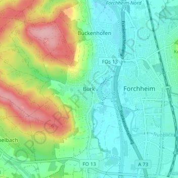
Name: Burk topographic map, elevation, terrain.
Average elevation: 292 m
Minimum elevation: 252 m
Maximum elevation: 383 m