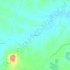
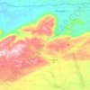
Cabaceiras topographic map
Click on the map to display elevation.
About this map

Name: Cabaceiras topographic map, elevation, terrain.
Location: Cabaceiras, Paraíba, Northeast Region, 58480-000, Brazil (-7.59736 -36.43851 -7.30793 -36.14283)
Average elevation: 450 m
Minimum elevation: 364 m
Maximum elevation: 712 m
Other topographic maps
Click on a map to view its topography, its elevation and its terrain.

Campina Grande
Brazil > Paraíba > Região Metropolitana de Campina Grande > Campina Grande
Average elevation: 498 m
Serra da Borborema
Brazil > Paraíba > Região Metropolitana de Patos > Cacimbas
Average elevation: 573 m