Geolocate

Sitges topographic map

Click on the map to display elevation.

About this map
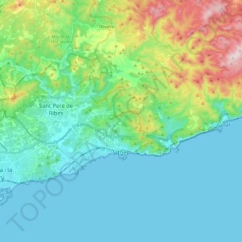
Name: Sitges topographic map, elevation, terrain.

Location: Sitges, Garraf, Barcelona, Catalonia, Spain (41.21859 1.75620 41.29134 1.94493)

Average elevation: 125 m

Minimum elevation: -1 m

Maximum elevation: 561 m

Other topographic maps

Click on a map to view its topography, its elevation and its terrain.
Gear up for your next adventure:

🛶Canoe Life Vest - Safety vest for water sports
💧Hydration Bladder - Hands-free hydration solution for long treks
🔨Vehicle Emergency Tool - Safety tool for remote road trips to trailheads
🥾Waterproof Trail Shoes - Shoes designed to handle wet terrain
🥾Trail Hiking Boots - Supportive boots for rough trails

As an Amazon Associate, this site earns from qualifying purchases at no extra cost to you.