Geolocate

Svetly topographic map

Click on the map to display elevation.

About this map
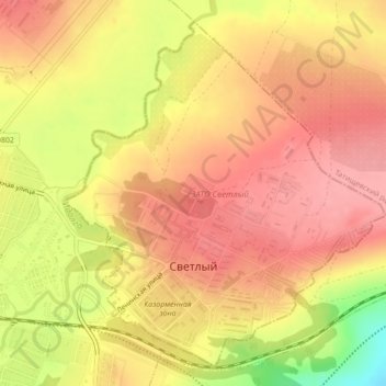
Name: Svetly topographic map, elevation, terrain.

Location: Svetly, Saratov Oblast, Volga Federal District, 412163, Russia (51.66674 45.60844 51.69079 45.64453)

Average elevation: 202 m

Minimum elevation: 133 m

Maximum elevation: 235 m

Other topographic maps

Click on a map to view its topography, its elevation and its terrain.

Baranovka

Russia > Saratov Oblast > Volsky District

Average elevation: 46 m

Алай

Russia > Saratov Oblast > Baltaysky District

Average elevation: 115 m

Михайловка

Russia > Saratov Oblast > Saratov

Average elevation: 209 m

Gear up for your next adventure:

🧴Outdoor Sunscreen - High SPF protection for high-altitude UV exposure
🥤Collapsible Travel Cup - Saves space and weight in your mess kit
⛺Backpacking Tent - Lightweight tent for long-distance hiking trips
🧤Thermal Hiking Gloves - Grip-enhanced gloves for cold-weather altitude trekking
🛶Kayak Dry Bag - Waterproof storage for kayaking adventures

As an Amazon Associate, this site earns from qualifying purchases at no extra cost to you.