Geolocate

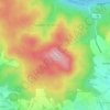
Oftering topographic map

Click on the map to display elevation.

About this map

Name: Oftering topographic map, elevation, terrain.

Location: Oftering, Bezirk Linz-Land, Upper Austria, 4064, Austria (48.21896 14.09132 48.25384 14.16500)

Average elevation: 324 m

Minimum elevation: 285 m

Maximum elevation: 437 m

Other topographic maps

Click on a map to view its topography, its elevation and its terrain.
Holzheim

Austria > Upper Austria > Bezirk Linz-Land > Leonding

Average elevation: 309 m

Kürnberg

Austria > Upper Austria > Bezirk Linz-Land > Wilhering

Average elevation: 382 m

Reith

Austria > Upper Austria > Bezirk Linz-Land > Leonding

Average elevation: 289 m

Wagram

Austria > Upper Austria > Bezirk Linz-Land

Average elevation: 282 m

Reith

Austria > Upper Austria > Bezirk Linz-Land > Leonding

Average elevation: 289 m

Gear up for your next adventure:

💧Reusable Water Bottle - Durable water bottles for hydration on trails
🧭GPS Tracker - Track your location in remote areas safely
👟Trail Running Shoes - Agile footwear for fast-paced topographic exploration
🥾Trekking Poles - Adjustable trekking poles to reduce knee stress and improve stability
🔥Camping Stove - Portable stoves to cook outdoors with ease

As an Amazon Associate, this site earns from qualifying purchases at no extra cost to you.