Make a donation
Gear up for your next adventure:
As an Amazon Associate, this site earns from qualifying purchases at no extra cost to you.
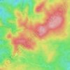
Krupka topographic map
Click on the map to display elevation.
Make a donation
Gear up for your next adventure:
As an Amazon Associate, this site earns from qualifying purchases at no extra cost to you.
About this map
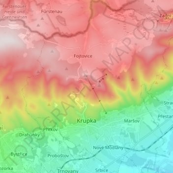
Name: Krupka topographic map, elevation, terrain.
Location: Krupka, okres Teplice, Ústecký kraj, Northwest, Czechia (50.65918 13.80837 50.74280 13.92886)
Average elevation: 526 m
Minimum elevation: 171 m
Maximum elevation: 876 m
Make a donation
Gear up for your next adventure:
As an Amazon Associate, this site earns from qualifying purchases at no extra cost to you.
Other topographic maps
Click on a map to view its topography, its elevation and its terrain.

Make a donation
Gear up for your next adventure:
As an Amazon Associate, this site earns from qualifying purchases at no extra cost to you.


Ore Mountains
Czechia > Northwest > Ústecký kraj > Loučná pod Klínovcem
The topographical transition from the Western and Central Ore Mountains to the loess hill country to the north between Zwickau and Chemnitz is referred to as the Ore Mountain Basin; that from the Eastern Ore Mountains as the Ore Mountain Foreland. Between Freital and Pirna, the area is called the Dresden Ore…
Average elevation: 1,020 m
Make a donation
Gear up for your next adventure:
As an Amazon Associate, this site earns from qualifying purchases at no extra cost to you.