Geolocate

Giradot topographic map

Click on the map to display elevation.

About this map

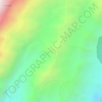
Name: Giradot topographic map, elevation, terrain.

Location: Giradot, Chima, Comunera, Santander, Colombia (6.36526 -73.39508 6.38526 -73.37508)

Average elevation: 1,500 m

Minimum elevation: 1,150 m

Maximum elevation: 2,078 m

Gear up for your next adventure:

🔋Lithium AA Batteries - Long-lasting power that performs in extreme cold
🔋Emergency Crank Radio - Weather alerts and power without needing batteries
🥾Waterproof Trail Shoes - Shoes designed to handle wet terrain
🥾Hiking Shoes - Durable and comfortable shoes for trail hiking
📷Outdoor Action Camera - Capture high-elevation views and rugged adventures

As an Amazon Associate, this site earns from qualifying purchases at no extra cost to you.