Geolocate

Sins topographic map

Click on the map to display elevation.

About this map

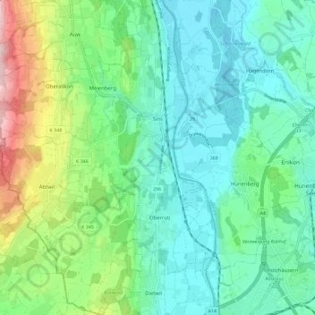
Name: Sins topographic map, elevation, terrain.

Location: Sins, Bezirk Muri, Aargau, Switzerland (47.14305 8.33002 47.21997 8.40532)

Average elevation: 465 m

Minimum elevation: 386 m

Maximum elevation: 701 m

Gear up for your next adventure:

🔭Compact Monocular - One-handed bird watching and trail spotting
🥾Mountain Trail Shoes - High-traction shoes for mountain trails
🧢Outdoor Visor - Breathable visor for sunny hikes
🥤Collapsible Travel Cup - Saves space and weight in your mess kit
🧭GPS Outdoor Watch - Smart watch for navigation and fitness tracking in nature

As an Amazon Associate, this site earns from qualifying purchases at no extra cost to you.