Geolocate

Trient topographic map

Click on the map to display elevation.

About this map
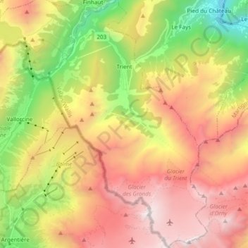
Name: Trient topographic map, elevation, terrain.

Location: Trient, Martigny, Bas-Valais, Valais/Wallis, 1929, Switzerland (45.98058 6.94832 46.08371 7.04523)

Average elevation: 2,018 m

Minimum elevation: 513 m

Maximum elevation: 3,523 m

Gear up for your next adventure:

🕶️Polarized Sunglasses - Protect your eyes with durable polarized lenses
🥾Durable Hiking Shoes - Long-lasting shoes for frequent hiking
🧢Outdoor Cap - Protective cap for sun and rain during hikes
⛺Tent Footprint - Protect tent floor and increase durability
⛺Camping Tent - Weather-resistant tents suitable for 2 to 6 people

As an Amazon Associate, this site earns from qualifying purchases at no extra cost to you.