
Thank you for supporting this site ❤️
Make a donation
Make a donation
Gear up for your next adventure:
As an Amazon Associate, this site earns from qualifying purchases at no extra cost to you.
Choupica topographic map
Click on the map to display elevation.
Thank you for supporting this site ❤️
Make a donation
Make a donation
Gear up for your next adventure:
As an Amazon Associate, this site earns from qualifying purchases at no extra cost to you.
About this map
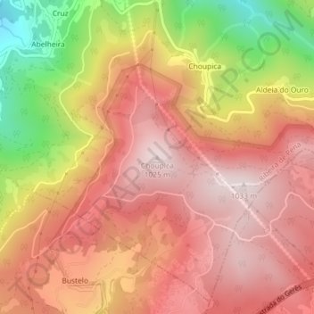
Name: Choupica topographic map, elevation, terrain.
Location: Choupica, Ribeira de Pena, Vila Real, 4870-161, Portugal (41.51827 -7.75904 41.51837 -7.75894)
Average elevation: 800 m
Minimum elevation: 403 m
Maximum elevation: 1,029 m
Thank you for supporting this site ❤️
Make a donation
Make a donation
Gear up for your next adventure:
As an Amazon Associate, this site earns from qualifying purchases at no extra cost to you.