Geolocate

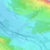
Koblach topographic map

Click on the map to display elevation.

About this map

Name: Koblach topographic map, elevation, terrain.

Location: Koblach, Bezirk Feldkirch, Vorarlberg, 6842, Austria (47.30564 9.58829 47.34646 9.63880)

Average elevation: 433 m

Minimum elevation: 410 m

Maximum elevation: 647 m

Other topographic maps

Click on a map to view its topography, its elevation and its terrain.
Gear up for your next adventure:

🏃Hydration Running Vest - Carry water and maps close to your body for speed
🎒Backpack Rain Cover - External shield to keep your entire pack dry
🧦Thermal Socks - Warm socks for winter hiking or camping
🪜Heavy Duty Carabiners - Multi-use clips for securing gear to your backpack
🕶️Polarized Sunglasses - Reduces glare from snow and water at high elevations

As an Amazon Associate, this site earns from qualifying purchases at no extra cost to you.