Geolocate

Keith topographic map

Click on the map to display elevation.

About this map

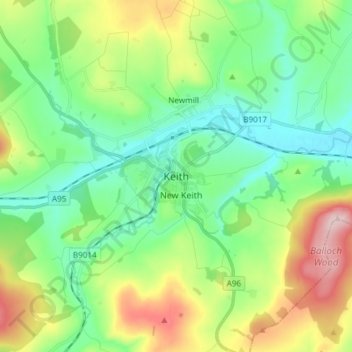
Name: Keith topographic map, elevation, terrain.

Location: Keith, Moray, Scotland, AB55 5FF, United Kingdom (57.50273 -2.99233 57.58273 -2.91233)

Average elevation: 180 m

Minimum elevation: 96 m

Maximum elevation: 364 m

Gear up for your next adventure:

🦌Outdoor Trail Camera - Monitor wildlife activity near your favorite spots
🔨Vehicle Emergency Tool - Safety tool for remote road trips to trailheads
🛌Down Sleeping Bag - Superior warmth-to-weight ratio for cold nights
🥾Hiking Shoes - Durable and comfortable shoes for trail hiking
Camping Essentials - All-in-one gear for a comfortable camping trip

As an Amazon Associate, this site earns from qualifying purchases at no extra cost to you.