Geolocate

Sainik Farm topographic map

Click on the map to display elevation.

About this map

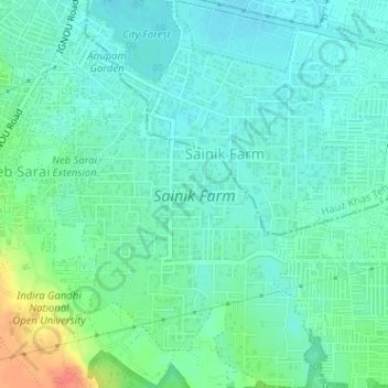
Name: Sainik Farm topographic map, elevation, terrain.

Location: Sainik Farm, Saket Tehsil, South Delhi, Delhi, India (28.48982 77.20666 28.51783 77.22852)

Average elevation: 239 m

Minimum elevation: 227 m

Maximum elevation: 272 m

Other topographic maps

Click on a map to view its topography, its elevation and its terrain.

Qila Rai Pithora

India > Delhi > Saket Tehsil

Average elevation: 242 m

Gear up for your next adventure:

🧭Orienteering Kit - Tools for map reading and navigation in the wild
🍽️Titanium Camping Spork - Ultralight and indestructible eating utensil
🥽Outdoor Goggles - Protective eyewear for outdoor activities
🕶️Polarized Sunglasses - Protect your eyes with durable polarized lenses
👟Sport Hiking Sandals - Breathable footwear for water crossings and camp rest

As an Amazon Associate, this site earns from qualifying purchases at no extra cost to you.