Geolocate

Col Saint-Roch topographic map

Click on the map to display elevation.

About this map
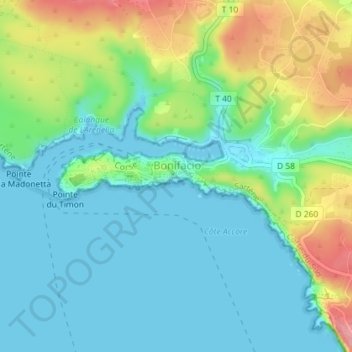
Name: Col Saint-Roch topographic map, elevation, terrain.

Location: Col Saint-Roch, Bonifacio / Bunifaziu, Sartène, Corse-du-Sud, Corse, France métropolitaine, 20169, France (41.38694 9.16045 41.38704 9.16055)

Average elevation: 31 m

Minimum elevation: -1 m

Maximum elevation: 105 m

Other topographic maps

Click on a map to view its topography, its elevation and its terrain.

Rondinara

France > Corse > Corse-du-Sud > Bonifacio / Bunifaziu

Average elevation: 30 m

Gear up for your next adventure:

🧳Compression Sacks - Maximize space in your backpack by shrinking gear
🥾Durable Hiking Shoes - Long-lasting shoes for frequent hiking
🪜Heavy Duty Carabiners - Multi-use clips for securing gear to your backpack
🧦Thermal Socks - Warm socks for winter hiking or camping
🦶Anti-Blister Balm - Prevents friction and hotspots during long ascents

As an Amazon Associate, this site earns from qualifying purchases at no extra cost to you.