Geolocate

Moss Landing topographic map

Click on the map to display elevation.

Moss Landing

Moss Landing, formerly Moss, is an unincorporated community and census-designated place (CDP) in Monterey County, California, United States. As of the 2020 census, Moss Landing had a population of 237. It is located 18 miles (29 km) north-northeast of Monterey, at an elevation of 10 feet (3.048 m). It is on the shore of Monterey Bay, at the mouth of Elkhorn Slough and at the head of the submarine Monterey Canyon.

Wikipedia (CC-BY-SA 3.0)

About this map

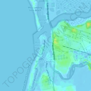
Name: Moss Landing topographic map, elevation, terrain.

Location: Moss Landing, Thompson, Moss Landing, Monterey County, California, United States (36.79019 -121.79378 36.81695 -121.78318)

Average elevation: 1 m

Minimum elevation: -6 m

Maximum elevation: 18 m

Gear up for your next adventure:

🕶️Polarized Sunglasses - Reduces glare from snow and water at high elevations
🔥Emergency Fire Starter - Reliable ignition source for all weather conditions
👖Convertible Hiking Pants - Zip-off legs to adapt to changing weather conditions
🧴Outdoor Sunscreen - High SPF protection for high-altitude UV exposure
🚲Bike Repair Kit - Essential tools for on-trail mechanical issues

As an Amazon Associate, this site earns from qualifying purchases at no extra cost to you.