Geolocate

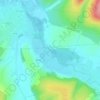
Poinchy topographic map

Click on the map to display elevation.

About this map

Name: Poinchy topographic map, elevation, terrain.

Location: Poinchy, Chablis, Auxerre, Yonne, Bourgogne-Franche-Comté, France métropolitaine, 89800, France (47.81790 3.75218 47.83801 3.81353)

Average elevation: 173 m

Minimum elevation: 121 m

Maximum elevation: 257 m

Other topographic maps

Click on a map to view its topography, its elevation and its terrain.

Les Preuses

France > Bourgogne-Franche-Comté > Yonne > Chablis

Average elevation: 167 m

Ru de Crioux

France > Bourgogne-Franche-Comté > Yonne > Chablis

Average elevation: 156 m

Gear up for your next adventure:

🧼Travel Hand Sanitizer - Keep hands clean when water is scarce
🧦Merino Wool Socks - Moisture-wicking comfort for long-distance hiking
🥾Hiking Leggings - Comfortable leggings for outdoor activities
🥾Hiking Boots - Sturdy boots providing ankle support and traction on rugged trails
🦯Trekking Poles - Reduced impact on joints for steep topographic climbs

As an Amazon Associate, this site earns from qualifying purchases at no extra cost to you.