

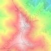
Kajaran topographic map
Click on the map to display elevation.
Kajaran
Kajaran belongs to the South Water Basin Management area. River Voghji (the length is 82 km, the catchment area is 1175sq.km) flows through the city; it starts from the confluence of Kajarants and Kaputjugh rivers, 6 km away from the Kajaran. Voghji is a typical mountain river with rugged stream bed and developed hydrographic network. It feeds both from thawing snow runoffs and groundwaters, with prevalence of one of its tributaries, Tzaghkari. It then flows into Arax river, at an altitude of 350m above sea level.
About this map

Name: Kajaran topographic map, elevation, terrain.
Location: Kajaran, Kajaran community, Syunik Province, 3309, Armenia (39.14781 46.13637 39.16225 46.17309)
Average elevation: 2,028 m
Minimum elevation: 1,661 m
Maximum elevation: 2,529 m
Other topographic maps
Click on a map to view its topography, its elevation and its terrain.

Goris
Goris is situated in the valley of Goris River, also known as Vararak River. The valley is surrounded with the Zangezur Mountains. The town has an average elevation of 1,385 metres above sea level. The surrounding mountains are famous for their medieval cave-dwellings carved out of the soft rock in the…
Average elevation: 1,513 m

Kapan
The town is about 80 km (50 mi) north of the Iranian border. With a height of 3201 meters, Mount Khustup is the highest peak of the region. The elevation of Kapan is 750–1050 meters above sea level, with an average height of 910 meters. Two tributaries of the Voghji River, Vachagan and Kavart, flow through…
Average elevation: 1,080 m
Goris
Goris is situated in the valley of Goris River, also known as Vararak River. The valley is surrounded with the Zangezur Mountains. The town has an average elevation of 1,385 metres above sea level. The surrounding mountains are famous for their medieval cave-dwellings carved out of the soft rock in the…
Average elevation: 1,513 m