Geolocate

Erenyaka topographic map

Click on the map to display elevation.

About this map

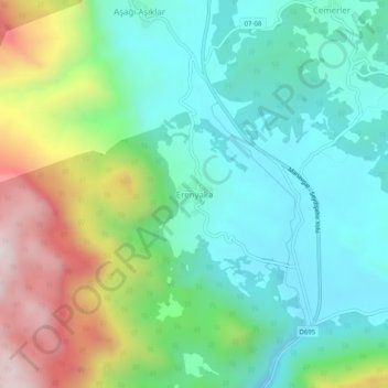
Name: Erenyaka topographic map, elevation, terrain.

Location: Erenyaka, Akseki, Antalya, Mediterranean Region, Turkey (36.90925 31.72974 36.94925 31.76974)

Average elevation: 840 m

Minimum elevation: 588 m

Maximum elevation: 1,419 m

Gear up for your next adventure:

🧢Hiking Hat - Sun-protective and breathable hats for long treks
🧴Insect Repellent - Protect yourself from bugs during outdoor adventures
🔭Compact Binoculars - Lightweight optics for scouting trails and wildlife
🚲Handlebar Phone Mount - View topographic-map.com live while cycling
🔦LED Headlamp - Hands-free lighting for early morning starts or late finishes

As an Amazon Associate, this site earns from qualifying purchases at no extra cost to you.