
Thank you for supporting this site ❤️
Make a donation
Make a donation
Gear up for your next adventure:
As an Amazon Associate, this site earns from qualifying purchases at no extra cost to you.
Kahraman topographic map
Click on the map to display elevation.
Thank you for supporting this site ❤️
Make a donation
Make a donation
Gear up for your next adventure:
As an Amazon Associate, this site earns from qualifying purchases at no extra cost to you.
About this map
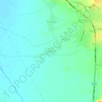
Name: Kahraman topographic map, elevation, terrain.
Location: Kahraman, Çine, Aydın, Egeïsche Regio, Turkije (37.58366 28.01767 37.62366 28.05767)
Average elevation: 65 m
Minimum elevation: 56 m
Maximum elevation: 94 m
Thank you for supporting this site ❤️
Make a donation
Make a donation
Gear up for your next adventure:
As an Amazon Associate, this site earns from qualifying purchases at no extra cost to you.