Geolocate

Chacan topographic map

Click on the map to display elevation.

About this map

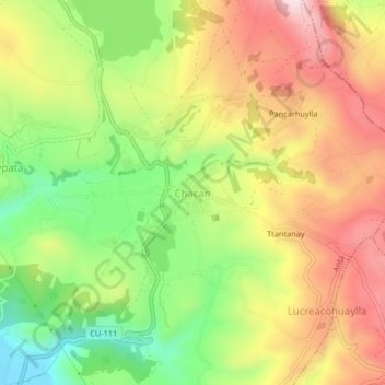
Name: Chacan topographic map, elevation, terrain.

Location: Chacan, Anta, Cusco, 08616, Perú (-13.45049 -72.14722 -13.41049 -72.10722)

Average elevation: 3,557 m

Minimum elevation: 3,342 m

Maximum elevation: 3,772 m

Gear up for your next adventure:

🧥Softshell Jacket - Windproof and breathable jacket for hiking
❄️Traction Ice Cleats - Slip-on spikes for icy trails and winter hiking
🚲MTB Frame Bag - Carry tools and maps directly on your bicycle frame
🔦LED Flashlight - Powerful and long-lasting flashlight for camping and emergencies
🥾Trail Hiking Socks - Comfortable socks to prevent blisters and fatigue

As an Amazon Associate, this site earns from qualifying purchases at no extra cost to you.