Geolocate

Portomarín topographic map

Click on the map to display elevation.

About this map
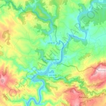
Name: Portomarín topographic map, elevation, terrain.

Location: Portomarín, Lugo, Galicia, Spain (42.75574 -7.76564 42.87528 -7.59868)

Average elevation: 474 m

Minimum elevation: 324 m

Maximum elevation: 777 m

Other topographic maps

Click on a map to view its topography, its elevation and its terrain.

Quintián

Spain > Galicia > Lugo

Average elevation: 490 m

Outeiro Pequeno

Spain > Galicia > Lugo > Portomarín

Average elevation: 530 m

Gear up for your next adventure:

🚑Survival Whistle - Signal for help across long distances in mountains
🧼Travel Hand Sanitizer - Keep hands clean when water is scarce
🧰Emergency Multi-Tool - Compact multi-tool for outdoor survival
🥾All-Terrain Hiking Boots - Versatile boots for varied hiking conditions
🌡️Emergency Mylar Blankets - Compact thermal protection for unexpected nights outdoors

As an Amazon Associate, this site earns from qualifying purchases at no extra cost to you.