
Thank you for supporting this site ❤️
Make a donation
Make a donation
Gear up for your next adventure:
As an Amazon Associate, this site earns from qualifying purchases at no extra cost to you.
Bersia topographic map
Click on the map to display elevation.
Thank you for supporting this site ❤️
Make a donation
Make a donation
Gear up for your next adventure:
As an Amazon Associate, this site earns from qualifying purchases at no extra cost to you.
About this map
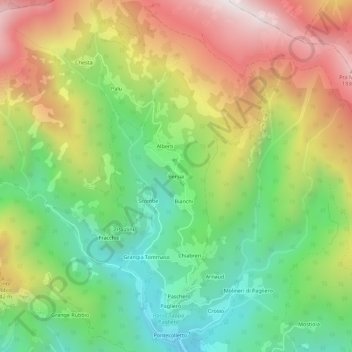
Name: Bersia topographic map, elevation, terrain.
Location: Bersia, San Damiano Macra, Cuneo, Piedmont, 12020, Italy (44.49886 7.22787 44.53886 7.26787)
Average elevation: 1,336 m
Minimum elevation: 821 m
Maximum elevation: 2,017 m
Thank you for supporting this site ❤️
Make a donation
Make a donation
Gear up for your next adventure:
As an Amazon Associate, this site earns from qualifying purchases at no extra cost to you.