Geolocate

Dusch topographic map

Click on the map to display elevation.

About this map

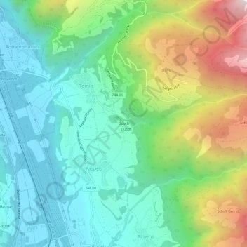
Name: Dusch topographic map, elevation, terrain.

Location: Dusch, Paspels, Domleschg, Viamala, Grisons, 7417, Switzerland (46.73596 9.43115 46.77596 9.47115)

Average elevation: 1,042 m

Minimum elevation: 616 m

Maximum elevation: 2,023 m

Gear up for your next adventure:

🔭Outdoor Binoculars - Lightweight binoculars for birdwatching and hiking
🧴Bear Spray Holster - Quick-access carry for essential Canadian wilderness safety
🧭GPS Handheld Device - Reliable GPS navigation for outdoor adventures
🧢Outdoor Cap - Protective cap for sun and rain during hikes
🧦Crew Hiking Socks - Comfortable socks for long-distance hikes

As an Amazon Associate, this site earns from qualifying purchases at no extra cost to you.