Geolocate

Coles topographic map

Click on the map to display elevation.

About this map

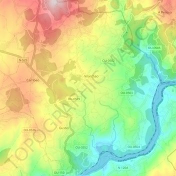
Name: Coles topographic map, elevation, terrain.

Location: Coles, Ourense, Galicia, 32152, Spain (42.37019 -7.88539 42.44497 -7.79718)

Average elevation: 343 m

Minimum elevation: 106 m

Maximum elevation: 669 m

Gear up for your next adventure:

🧰Survival Kit - Essential gear for emergencies in the wilderness
🚲Handlebar Phone Mount - View topographic-map.com live while cycling
🥾Approach Boots - Comfortable boots for hiking and climbing approaches
🏃Hydration Running Vest - Carry water and maps close to your body for speed
🔭Compact Monocular - One-handed bird watching and trail spotting

As an Amazon Associate, this site earns from qualifying purchases at no extra cost to you.