
Dittelbrunn topographic map
Click on the map to display elevation.
Dittelbrunn
Die Gemeinde liegt unmittelbar nördlich Schweinfurts und am Westrand der Schweinfurter Rhön. Die höchste Erhebung ist der Wachtler Berg (384 m). Auf dem Gemeindegebiet entspringt der Marienbach. Im Süden grenzen direkt die Schweinfurter Stadtteile Eselshöhe und Haardt an. Dittelbrunn ist baulich mit der kreisfreien Stadt Schweinfurt zusammengewachsen und wegen seiner Lage am Rande der Schweinfurter Rhön ein beliebter Wohnort.
About this map
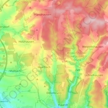
Name: Dittelbrunn topographic map, elevation, terrain.
Location: Dittelbrunn, Landkreis Schweinfurt, Bayern, 97456, Deutschland (50.06582 10.16868 50.15007 10.23498)
Average elevation: 328 m
Minimum elevation: 228 m
Maximum elevation: 424 m
Other topographic maps
Click on a map to view its topography, its elevation and its terrain.
Oberwerrn
Deutschland > Bayern > Landkreis Schweinfurt > Oberwerrn
Der Fluss Wern durchfließt in einer über 100 m breiten Talsohle die Gemarkung von NW nach SO. Im Ortsbereich beträgt der Höhenunterschied vom Werntalgrund (234 m ü. NN) zu den Höhen (ca. 265 m ü. NN) gut 30 m. Die durch die Flußeinschneidung angeschnittenen Gesteinsschichten des Unterkeupers sind nur…
Average elevation: 256 m
Handthal
Deutschland > Bayern > Landkreis Schweinfurt
Den Mittelpunkt der Siedlung bildet die katholische Filialkirche St. Maria Magdalena. Ursprünglich stand sie auf der Höhe des Madgalenenberges und war das Ziel vieler Pilger. Sie wurde 1729 geweiht. Im Jahr 1810 wurde den Handthalern der Wiederaufbau der aufgelösten Hospizkirche genehmigt und die…
Average elevation: 380 m
Wülfershausen
Deutschland > Bayern > Landkreis Schweinfurt
Das Kirchdorf Wülfershausen liegt auf einer Höhe von etwa 300 m ü. NHN und hat ca. 500 Einwohner. Das Kirchdorf liegt an der Staatsstraße 2433 und am Fränkischen Marienweg.
Average elevation: 301 m
Vasbühl
Deutschland > Bayern > Landkreis Schweinfurt
Vasbühl liegt fünf Kilometer nordwestlich von Werneck auf einem Höhenrücken zwischen Schwebenried und Egenhausen. Im Ortsgebiet entspringt der Dorfgraben, ein Quellfluss der Wern.
Average elevation: 301 m
Heidenfeld
Deutschland > Bayern > Landkreis Schweinfurt > Röthlein
In der 1906 erbauten Pfarrkirche St. Laurentius ruhen die Gebeine des am 24. März 1974 seliggesprochenen Märtyrerpriesters Liborius Wagner. Seitdem kommen viele Wallfahrer nach Heidenfeld zur Verehrung des Seligen; ihren Höhepunkt hatte diese Verehrung mit der Feier des 350. Todesjahres im Jahre 1981.
Average elevation: 210 m