Geolocate

Dragani topographic map

Click on the map to display elevation.

About this map

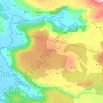
Name: Dragani topographic map, elevation, terrain.

Location: Dragani, Podi, Grad Trilj, 21242, Croatia (43.63853 16.75733 43.67853 16.79733)

Average elevation: 415 m

Minimum elevation: 290 m

Maximum elevation: 585 m

Gear up for your next adventure:

🥾Mountain Hiking Shoes - Shoes with superior grip for mountainous terrain
🧥Packable Rain Jacket - Breathable waterproof layer for unpredictable weather
🥾Hiking Boots - Sturdy boots providing ankle support and traction on rugged trails
Family Camping Tent - Spacious tent suitable for family camping trips
🚲Heavy Duty Bike Lock - Secure your bike at the trailhead or during stops

As an Amazon Associate, this site earns from qualifying purchases at no extra cost to you.