Geolocate

Lille topographic map

Click on the map to display elevation.

About this map

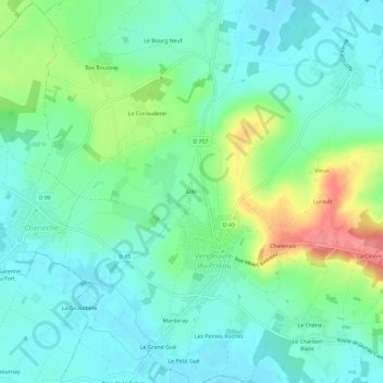
Name: Lille topographic map, elevation, terrain.

Location: Lille, Vendeuvre-du-Poitou, Saint-Martin-la-Pallu, Poitiers, Vienne, Nouvelle-Aquitaine, France métropolitaine, 86380, France (46.72183 0.28551 46.76183 0.32551)

Average elevation: 99 m

Minimum elevation: 75 m

Maximum elevation: 159 m

Other topographic maps

Click on a map to view its topography, its elevation and its terrain.

Gear up for your next adventure:

🧢Beanie Hat - Keep your head warm in cold weather
🗺️Topographic Maps - Detailed maps to explore trails, mountains, and wilderness areas
🥾Trail Running Shoes - Lightweight and durable shoes for trail running
🥾Waterproof Hiking Shoes - Durable shoes for wet and rugged trails
🎒Hiking Backpack - Lightweight and ergonomic backpacks for day hikes or multi-day treks

As an Amazon Associate, this site earns from qualifying purchases at no extra cost to you.