Geolocate

Carcente topographic map

Click on the map to display elevation.

About this map

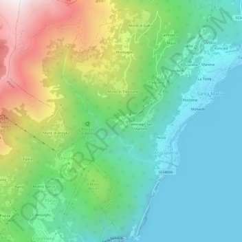
Name: Carcente topographic map, elevation, terrain.

Location: Carcente, Acquaseria, San Siro, Como, Lombardy, 22010, Italy (46.03952 9.22695 46.07952 9.26695)

Average elevation: 693 m

Minimum elevation: 190 m

Maximum elevation: 1,833 m

Gear up for your next adventure:

🧭GPS Outdoor Watch - Smart watch for navigation and fitness tracking in nature
Tent Footprint - Protect tent floor and increase durability
🥾Trail Hiking Socks - Comfortable socks to prevent blisters and fatigue
🧦Merino Wool Socks - Moisture-wicking comfort for long-distance hiking
🥾Mountain Trail Shoes - High-traction shoes for mountain trails

As an Amazon Associate, this site earns from qualifying purchases at no extra cost to you.