Geolocate

Azufral topographic map

Click on the map to display elevation.

Azufral

El Azufral es un volcán semiactivo ubicado en la región andina del departamento colombiano de Nariño. Tiene una elevación de 4070 m s. n. m.

Wikipedia (CC-BY-SA 3.0)

About this map

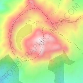
Name: Azufral topographic map, elevation, terrain.

Location: Azufral, Sapuyes, La Sabana, Nariño, RAP Pacífico, Colombia (1.08549 -77.71864 1.08559 -77.71854)

Average elevation: 3,771 m

Minimum elevation: 3,421 m

Maximum elevation: 4,039 m

Gear up for your next adventure:

🥾Approach Shoes - Shoes designed for climbing approaches and rugged trails
🧴First Aid Kit - Essential first aid supplies for outdoor emergencies
🔭Outdoor Binoculars - Lightweight binoculars for birdwatching and hiking
🧴Outdoor Sunscreen - High SPF protection for high-altitude UV exposure
🛌Insulated Sleeping Pad - Critical thermal barrier between you and the cold ground

As an Amazon Associate, this site earns from qualifying purchases at no extra cost to you.