Geolocate

Miltenberg topographic map

Click on the map to display elevation.

About this map

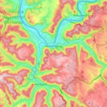
Name: Miltenberg topographic map, elevation, terrain.

Location: Miltenberg, Landkreis Miltenberg, Bavaria, 63897, Germany (49.65392 9.12120 49.72686 9.37267)

Average elevation: 310 m

Minimum elevation: 119 m

Maximum elevation: 513 m

Gear up for your next adventure:

🥤Collapsible Travel Cup - Saves space and weight in your mess kit
🥾Mountain Hiking Shoes - Shoes with superior grip for mountainous terrain
🕯️Camping Lantern - Illuminates your entire campsite with high-efficiency LEDs
🚲Handlebar Phone Mount - View topographic-map.com live while cycling
🧭GPS Tracker - Track your location in remote areas safely

As an Amazon Associate, this site earns from qualifying purchases at no extra cost to you.