Geolocate

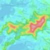
Kariong topographic map

Click on the map to display elevation.

About this map
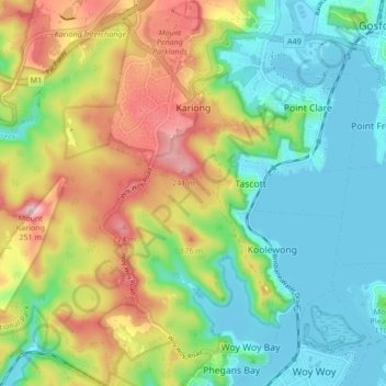
Name: Kariong topographic map, elevation, terrain.

Location: Kariong, Gosford, New South Wales, Australia (-33.49074 151.23533 -33.42044 151.31088)

Average elevation: 86 m

Minimum elevation: -2 m

Maximum elevation: 239 m

Other topographic maps

Click on a map to view its topography, its elevation and its terrain.
Mount White

Australia > New South Wales > Gosford

Average elevation: 139 m

Wyong River

Australia > New South Wales > Gosford

Average elevation: 175 m

Wamberal Beach

Australia > New South Wales > Gosford

Average elevation: 7 m

Mount Elliot

Australia > New South Wales > Gosford

Average elevation: 92 m

Erina Creek

Australia > New South Wales > Gosford

Average elevation: 23 m

Gear up for your next adventure:

🛁Quick-Dry Microfiber Towel - Space-saving towel that dries rapidly on the move
💡Compact LED Flashlight - Powerful and portable flashlight for outdoor use
🥾Hiking Leggings - Comfortable leggings for outdoor activities
🧰Emergency Multi-Tool - Compact multi-tool for outdoor survival
🎒Fully Waterproof Backpack - Total protection for photography gear and electronics

As an Amazon Associate, this site earns from qualifying purchases at no extra cost to you.