Geolocate

Toft Monks topographic map

Click on the map to display elevation.

About this map

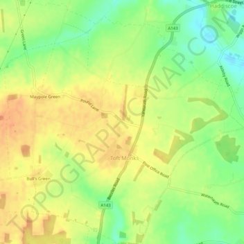
Name: Toft Monks topographic map, elevation, terrain.

Location: Toft Monks, South Norfolk, Norfolk, England, United Kingdom (52.48535 1.55327 52.51537 1.60179)

Average elevation: 22 m

Minimum elevation: 0 m

Maximum elevation: 38 m

Gear up for your next adventure:

👟Trail Running Shoes - Agile footwear for fast-paced topographic exploration
🥾Trail Running Boots - Durable shoes designed for trail running
💧Hydration Pack - Hands-free hydration system for long hikes
🕶️Polarized Sunglasses - Reduces glare from snow and water at high elevations
🧴Sunscreen SPF - Broad-spectrum sunscreen for outdoor activities

As an Amazon Associate, this site earns from qualifying purchases at no extra cost to you.