Geolocate

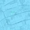
Hilversum topographic map

Click on the map to display elevation.

About this map

Name: Hilversum topographic map, elevation, terrain.

Location: Hilversum, North Holland, Netherlands (52.17768 5.10201 52.28555 5.21896)

Average elevation: 5 m

Minimum elevation: -4 m

Maximum elevation: 31 m

Other topographic maps

Click on a map to view its topography, its elevation and its terrain.
Ruigoord

Netherlands > North Holland > Amsterdam

Average elevation: 0 m

Oosterwijzend

Netherlands > North Holland > Hoogkarspel

Average elevation: -2 m

Gear up for your next adventure:

🚲MTB Frame Bag - Carry tools and maps directly on your bicycle frame
🧥Insulated Jacket - Keep warm in cold outdoor conditions
🧴Outdoor Sunscreen - High SPF protection for high-altitude UV exposure
🔭Compact Binoculars - Lightweight optics for scouting trails and wildlife
🛌Down Sleeping Bag - Superior warmth-to-weight ratio for cold nights

As an Amazon Associate, this site earns from qualifying purchases at no extra cost to you.