
Thank you for supporting this site ❤️
Make a donation
Make a donation
Gear up for your next adventure:
As an Amazon Associate, this site earns from qualifying purchases at no extra cost to you.
Burugupalle topographic map
Click on the map to display elevation.
Thank you for supporting this site ❤️
Make a donation
Make a donation
Gear up for your next adventure:
As an Amazon Associate, this site earns from qualifying purchases at no extra cost to you.
About this map
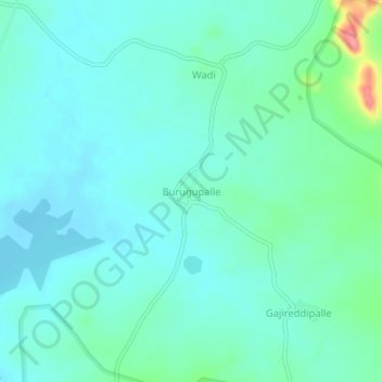
Name: Burugupalle topographic map, elevation, terrain.
Location: Burugupalle, Havelighanpur mandal, Medak, Telangana, India (18.12104 78.19374 18.16104 78.23374)
Average elevation: 460 m
Minimum elevation: 442 m
Maximum elevation: 534 m
Thank you for supporting this site ❤️
Make a donation
Make a donation
Gear up for your next adventure:
As an Amazon Associate, this site earns from qualifying purchases at no extra cost to you.